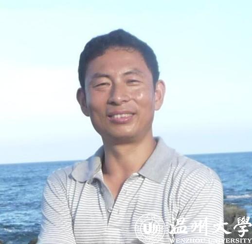
个人简介
李玉宝 男,内蒙古人,北京林业大学水土保持专业博士,温州大学环境工程专业硕士研究生导师(副研究员)。2002年以来,多次赴国外访学(美国堪萨斯州立大学1年,加拿大北英属哥伦比亚大学6个月,美国爱达荷州立大学3个月,比利时根特大学3个月)。
主要研究方向
数字图像处理、环境规划、水下数字地形及其应用、养殖海水处理。
主要社会兼职
加拿大北英属哥伦比亚大学兼职教授。
发表论文
1.邵帅(研究生)等. speciation and migration of heavy metals in sediment cores of urban wetland: bioavailability and risks. environmental science and pollution research, 2020, 6/6(通讯作者)
2.s. s. paul et al. assessing land use–land cover change and soil erosion potential using a combined approach through remote sensing, rusle and random forest algorithm. geocarto international, 2019, 25: 1010-6049, 3/3
3.夏锦梦(研究生)等. chemical speciation and risks of heavy metals in sediment of urban wetlands in southeastern china. soil & sediment contamination, 2019, 28: 1532-0383, 5/5(通讯作者)
4.s. s. paul et al. application of object oriented image classification and markov chain modeling for land use and land cover change analysis. journal of environmental informatics, 2018, 31:30-40, 4/4
5.陶国键(本科生)等. 污染底泥资源化选择软件的开发及其应用. 环境监测管理与技术,2018, 30:69-71, 4/4(通讯作者)
6.李玉宝等. heavy metals and nutrients (carbon, nitrogen, and phosphorus) in sediments: relationships to land uses, environmental risks, and management. environmental science and pollution research, 2017, 24: 7403–7412, 1/4
7.李玉宝等. bathymetric modeling of sediments and organic carbon of polluted rivers in southeastern china. journal od soils and sediments, 2016, 16: 2296-2305, 1/5
8.gao yong et al. effects of tillage methods on soil carbon and wind erosion. land degradation & development, 2015, 3: 583-591
科研课题
1.数字图像处理领域:利用地面数值影像评价沙表粗化过程技术引进,国家林业局948项目,20万,参加。
2.水下数字地形领域:主持浙江省科技计划项目、浙江省环境保护厅项目和温州市科技计划项目各1项,经费26万。
3.环境规划类项目:承担横向项目10余项,经费约80万元。
专著、获奖情况及个人荣誉
1.数字图像技术在地表风蚀监测中的应用, 科学出版社,2020年,第二主编。
2.湿地遥感调查技术,中国林业出版社,2011年,第二主编。
专利
污染底泥及其污染物的数量化方法,发明专利,2018年授权(已转让)。
承担的主要课程
环境专业英语,论文写作,环境信息系统,环境信息系统实验。

